LiDAR Scanning Services
We provide high-accuracy 3D laser scanning to capture existing conditions quickly and reliably. Our services deliver precise point cloud data and visual records that support design, construction, renovation, and asset management, while reducing site visits and uncertainty.
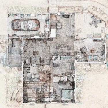
Detailed 3D laser scanning for capturing existing architectural, structural, and MEP conditions. Accurate point cloud data provides a reliable foundation for design, renovation, coordination, and as-built documentation.
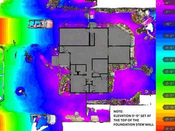
Visual elevation maps that make changes in surface height easy to understand at a glance. Useful for identifying slopes, high and low areas, drainage patterns, and other elevation changes across a site or surface. We can also provide cut/fill calculations for volumes.